Dronero night lights from space
Night Light of Dronero (Piedmont) from space (Italy) Src. Average luminocity for 10x10km area is 11.9063% and for 50x50km: 9.5791%.
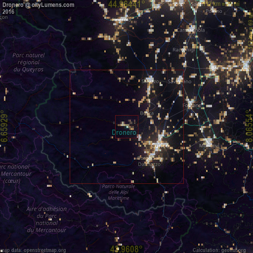
Analysis of Dronero night lights 2016
Square area 10x10 km:
 0%
0%90-99
1.9%80-89
1.75%70-79
0.32%60-69
0.63%50-59
1.59%40-49
4.44%30-39
3.97%20-29
1.75%10-19
0.95%0-9
82.7%Square area 50x50 km:
0.82%90-99
1.6%80-89
1.17%70-79
0.96%60-69
1.08%50-59
1.01%40-49
1.49%30-39
1.4%20-29
2.49%10-19
9.73%0-9
78.25%Clear (daylight) street map image can be seen on geolist.org.
Map coordinates:
44° 57' 51.9" North, 6° 39' 33.4" East
44° 27' 53.1" North, 7° 21' 44.7" East
43° 57' 38.9" North, 8° 3' 55.9" East
Some cities around Dronero sort by population:
• Cuneo
16.9 km =10.5 mi,  119°
119°
• Mondovì
36.9 km =22.9 mi,  101°
101°
• Fossano
29.9 km =18.6 mi,  71°
71°
• Savigliano
31 km =19.3 mi,  48°
48°
• Saluzzo
22.7 km =14.1 mi,  27°
27°
• Borgo San Dalmazzo
17.5 km =10.9 mi,  143°
143°
• Boves
21 km =13 mi, 135°
• Busca
10.7 km =6.6 mi,  57°
57°
3177474 (p: 5,454)
Sources (retrieved 2019-11-25):
» Earth at Night: Flat Maps 2012, 2016