Capri night lights from space
Night Light of Capri (Campania) from space (Italy) Src. Average luminocity for 10x10km area is 5.3799% and for 50x50km: 6.5396%.
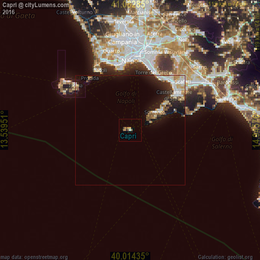
Analysis of Capri night lights 2016
Square area 10x10 km:
 0%
0%90-99
0.65%80-89
0.65%70-79
1.95%60-69
1.3%50-59
1.3%40-49
0%30-39
1.3%20-29
0%10-19
0%0-9
92.86%Square area 50x50 km:
1.05%90-99
1.38%80-89
0.8%70-79
0.75%60-69
0.58%50-59
1%40-49
0.35%30-39
0.78%20-29
1.83%10-19
4.62%0-9
86.86%Clear (daylight) street map image can be seen on geolist.org.
Map coordinates:
41° 4' 58.3" North, 13° 32' 22.2" East
40° 33' 2.6" North, 14° 14' 33.5" East
40° 0' 51.7" North, 14° 56' 44.7" East
Some cities around Capri sort by population:
• Sorrento
14.2 km =8.8 mi,  53°
53°
• Vico Equense
20.2 km =12.6 mi, 53°
• Piano di Sorrento
17.1 km =10.6 mi,  59°
59°
• Massa Lubrense
12.7 km =7.9 mi, 59°
• Sant'Agnello
15.9 km =9.9 mi, 56°
• Meta
17.7 km =11 mi, 55°
• Anacapri
2.6 km =1.6 mi,  272°
272°
• Pimonte
26.4 km =16.4 mi, 58°
3180630 (p: 6,770)
Sources (retrieved 2019-11-25):
» Earth at Night: Flat Maps 2012, 2016