Avella night lights from space
Night Light of Avella (Campania) from space (Italy) Src. Average luminocity for 10x10km area is 43.2092% and for 50x50km: 49.0033%.
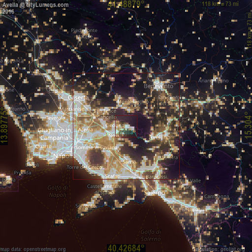
Analysis of Avella night lights 2016
Square area 10x10 km:
 5.61%
5.61%90-99
10.37%80-89
2.89%70-79
4.25%60-69
6.8%50-59
3.74%40-49
8.67%30-39
5.44%20-29
26.7%10-19
25.17%0-9
0.34%Square area 50x50 km:
8.2%90-99
10.8%80-89
5.52%70-79
6.68%60-69
8.53%50-59
6.85%40-49
5.52%30-39
8.1%20-29
13.62%10-19
17.53%0-9
8.64%Clear (daylight) street map image can be seen on geolist.org.
Map coordinates:
41° 29' 19.6" North, 13° 53' 51.9" East
40° 57' 35.8" North, 14° 36' 3.1" East
40° 25' 36.6" North, 15° 18' 14.4" East
Some cities around Avella sort by population:
• Nola
7.2 km =4.5 mi,  238°
238°
• Cicciano
5.6 km =3.5 mi,  274°
274°
• Cervinara
6.8 km =4.2 mi,  9°
9°
• Trescine
7.2 km =4.5 mi, 13°
• Cimitile
6.6 km =4.1 mi,  252°
252°
• Roccarainola
5.1 km =3.2 mi,  285°
285°
• Mugnano del Cardinale
3.5 km =2.2 mi,  123°
123°
• Camposano
6 km =3.7 mi,  262°
262°
3182651 (p: 7,372)
Sources (retrieved 2019-11-25):
» Earth at Night: Flat Maps 2012, 2016