Mahārāganj night lights from space
Night Light of Mahārāganj (Uttar Pradesh) from space (India) Src. Average luminocity for 10x10km area is 29.2576% and for 50x50km: 8.3257%.
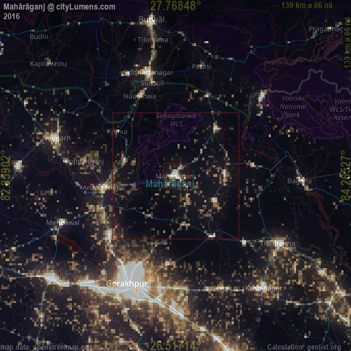
Analysis of Mahārāganj night lights 2016
Square area 10x10 km:
 4.73%
4.73%90-99
4.36%80-89
0.76%70-79
2.27%60-69
2.65%50-59
6.63%40-49
5.87%30-39
4.55%20-29
9.09%10-19
38.83%0-9
20.27%Square area 50x50 km:
0.36%90-99
0.4%80-89
0.26%70-79
0.52%60-69
0.96%50-59
1.53%40-49
2.05%30-39
3.07%20-29
3.71%10-19
6.41%0-9
80.72%Clear (daylight) street map image can be seen on geolist.org.
Map coordinates:
27° 46' 6.5" North, 82° 51' 32.5" East
27° 8' 40.4" North, 83° 33' 43.7" East
26° 31' 1.7" North, 84° 15' 55" East
Some cities around Mahārāganj sort by population:
• Nautanwa
34.5 km =21.4 mi,  335°
335°
• Siswā Bāzār
19.4 km =12.1 mi,  89°
89°
• Nichlaul
24.7 km =15.3 mi,  40°
40°
• Khada
32.1 km =19.9 mi,  82°
82°
• Pipraich
35.4 km =22 mi,  185°
185°
• Rāmkola
38.4 km =23.9 mi,  134°
134°
• Captainganj
28.5 km =17.7 mi,  148°
148°
• Anandnagar
29.2 km =18.1 mi,  260°
260°
1264433 (p: 30,548)
Sources (retrieved 2019-11-25):
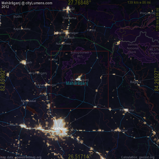
» Earth at Night: Flat Maps 2012, 2016