Machilīpatnam night lights from space
Night Light of Machilīpatnam (Andhra Pradesh) from space (India) Src. Average luminocity for 10x10km area is 45.1715% and for 50x50km: 8.5828%.
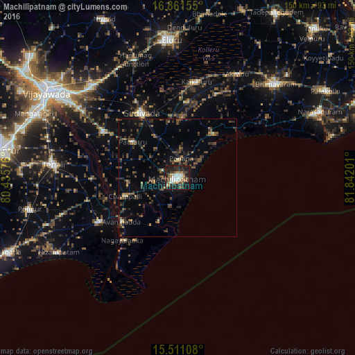
Analysis of Machilīpatnam night lights 2016
Square area 10x10 km:
 3.31%
3.31%90-99
13.02%80-89
4.75%70-79
3.72%60-69
6.82%50-59
4.55%40-49
8.26%30-39
10.54%20-29
20.87%10-19
22.93%0-9
1.24%Square area 50x50 km:
0.15%90-99
0.77%80-89
0.44%70-79
0.51%60-69
1.16%50-59
1.88%40-49
1.96%30-39
3%20-29
3.28%10-19
5.57%0-9
81.27%Clear (daylight) street map image can be seen on geolist.org.
Map coordinates:
16° 51' 41.6" North, 80° 26' 8.7" East
16° 11' 14.9" North, 81° 8' 20" East
15° 30' 39.9" North, 81° 50' 31.2" East
Some cities around Machilīpatnam sort by population:
• Gudivāda
31.5 km =19.6 mi,  330°
330°
• Kanuru
16.5 km =10.3 mi,  48°
48°
• Vuyyūru
37 km =23 mi,  301°
301°
• Pedana
7.6 km =4.7 mi,  3°
3°
• Avanigadda
29.9 km =18.6 mi,  231°
231°
• Challapalle
23.5 km =14.6 mi,  250°
250°
• Gudlavalleru
20.4 km =12.7 mi, 332°
• Korukollu
36.7 km =22.8 mi,  18°
18°
1264637 (p: 192,827)
Sources (retrieved 2019-11-25):
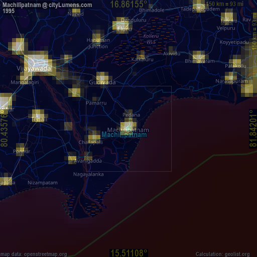
» NASA, Earths city lights 1995
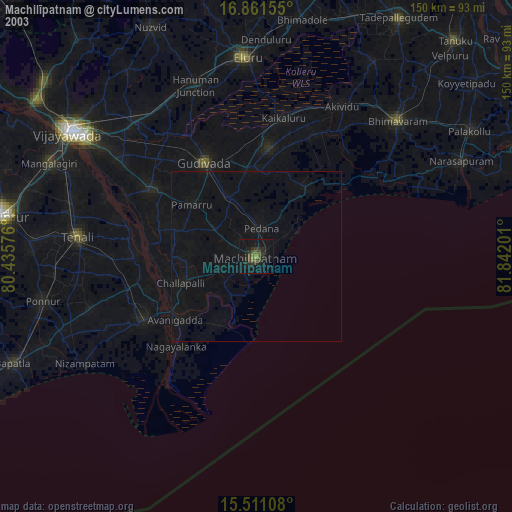
» NASA city lights 2003
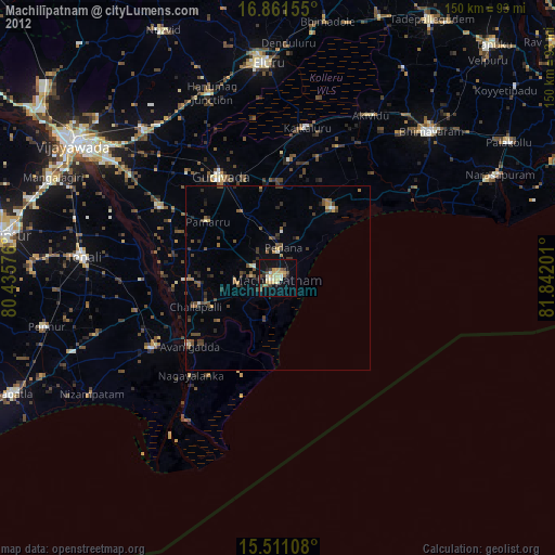
» Earth at Night: Flat Maps 2012, 2016