Bekasi night lights from space
Night Light of Bekasi (West Java) from space (Indonesia) Src. Average luminocity for 10x10km area is 99.9524% and for 50x50km: 69.1606%.
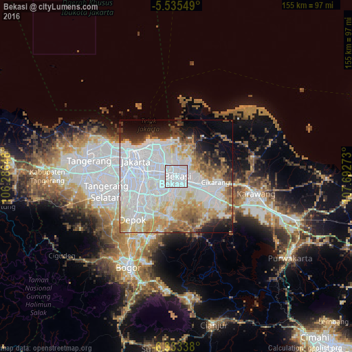
Analysis of Bekasi night lights 2016
Square area 10x10 km:
 95.89%
90-99
4.11%80-89
0%70-79
0%60-69
0%50-59
0%40-49
0%30-39
0%20-29
0%10-19
0%0-9
0%Square area 50x50 km:
34.27%90-99
13.02%80-89
6.73%70-79
6.83%60-69
5.99%50-59
4.45%40-49
3.53%30-39
3.37%20-29
4.56%10-19
5.84%0-9
11.41%Clear (daylight) street map image can be seen on geolist.org.
Map coordinates:
5° 32' 7.8" South, 106° 17' 11.3" East
6° 14' 5.6" South, 106° 59' 22.6" East
6° 56' 0.2" South, 107° 41' 33.8" East
Some cities around Bekasi sort by population:
• Jakarta
16.1 km =10 mi,  278°
278°
• South Tangerang
30.6 km =19 mi,  258°
258°
• Depok
26.3 km =16.3 mi,  225°
225°
• Cileungsir
18.1 km =11.2 mi,  190°
190°
• Pamulang
30.3 km =18.8 mi,  246°
246°
• Sawangan
30.2 km =18.8 mi, 231°
• Citeureup
30.3 km =18.8 mi,  203°
203°
• Cikarang
18.3 km =11.4 mi,  99°
99°
1649378 (p: 1,520,119)
Sources (retrieved 2019-11-25):
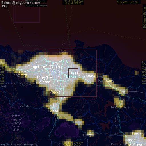
» NASA, Earths city lights 1995
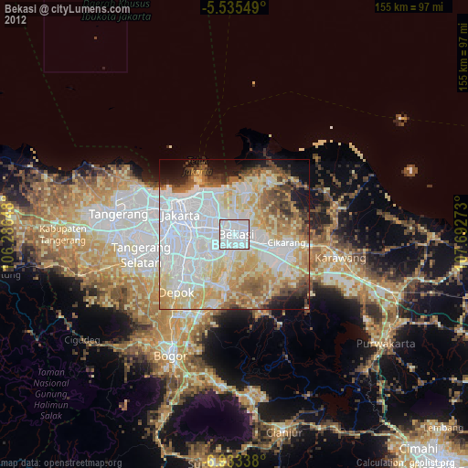
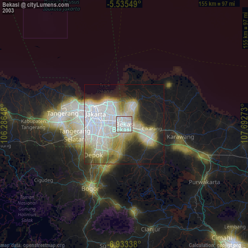
» NASA city lights 2003
» Earth at Night: Flat Maps 2012, 2016