Budapest XIII. kerület night lights from space
Night Light of Budapest XIII. kerület (Budapest) from space (Hungary) Src. Average luminocity for 10x10km area is 98.0952% and for 50x50km: 33.3877%.
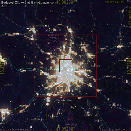
Analysis of Budapest XIII. kerület night lights 2016
Square area 10x10 km:
 79.97%
90-99
12.5%80-89
4.55%70-79
1.56%60-69
0.99%50-59
0.14%40-49
0.28%30-39
0%20-29
0%10-19
0%0-9
0%Square area 50x50 km:
10.31%90-99
6.01%80-89
2.42%70-79
2.78%60-69
3.4%50-59
4.22%40-49
4.54%30-39
5.34%20-29
6.92%10-19
14.79%0-9
39.27%Clear (daylight) street map image can be seen on geolist.org.
Map coordinates:
48° 0' 8.6" North, 18° 22' 39.2" East
47° 31' 47.2" North, 19° 4' 50.4" East
47° 3' 10.4" North, 19° 47' 1.7" East
Some cities around Budapest XIII. kerület sort by population:
• Zugló
2.3 km =1.4 mi,  126°
126°
• Kőbánya
6.7 km =4.2 mi,  139°
139°
• Józsefváros
4.5 km =2.8 mi,  187°
187°
• Erzsébetváros
3.1 km =1.9 mi, 191°
• Kispest
9.8 km =6.1 mi,  152°
152°
• Budaörs
11.9 km =7.4 mi,  230°
230°
• Budakeszi
11.7 km =7.3 mi,  259°
259°
• Csömör
11.7 km =7.3 mi,  78°
78°
7284830 (p: 113,531)
Sources (retrieved 2019-11-25):
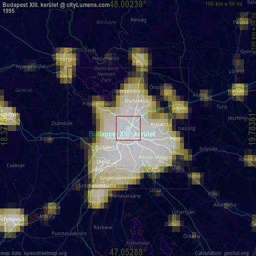
» NASA, Earths city lights 1995
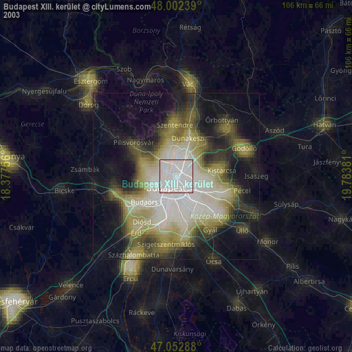
» NASA city lights 2003
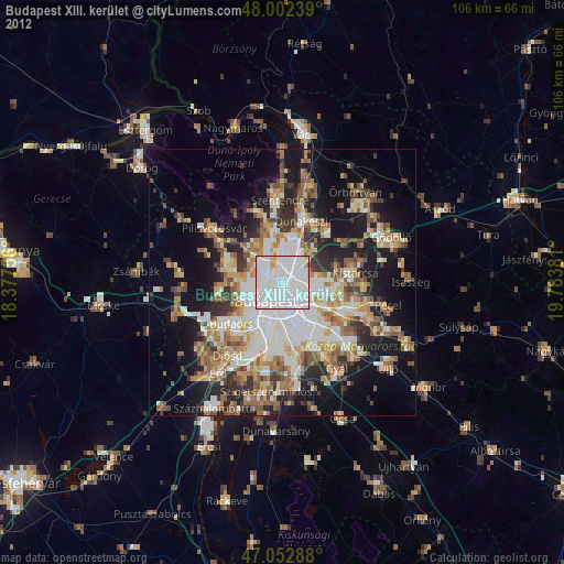
» Earth at Night: Flat Maps 2012, 2016