Budapest I. kerület night lights from space
Night Light of Budapest I. kerület (Budapest) from space (Hungary) Src. Average luminocity for 10x10km area is 97.6477% and for 50x50km: 33.7075%.
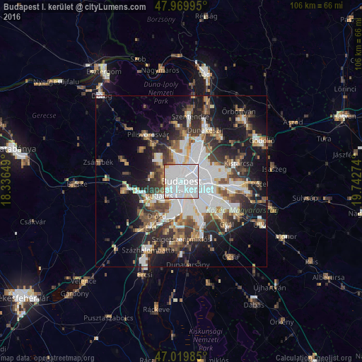
Analysis of Budapest I. kerület night lights 2016
Square area 10x10 km:
 76.56%
90-99
15.91%80-89
3.13%70-79
1.56%60-69
2.41%50-59
0%40-49
0.28%30-39
0.14%20-29
0%10-19
0%0-9
0%Square area 50x50 km:
10.52%90-99
6.18%80-89
2.4%70-79
2.74%60-69
3.42%50-59
4.21%40-49
4.58%30-39
5.26%20-29
7.04%10-19
14.98%0-9
38.68%Clear (daylight) street map image can be seen on geolist.org.
Map coordinates:
47° 58' 11.8" North, 18° 20' 11.4" East
47° 29' 49.4" North, 19° 2' 22.6" East
47° 1' 11.5" North, 19° 44' 33.9" East
Some cities around Budapest I. kerület sort by population:
• Zugló
5.4 km =3.4 mi,  65°
65°
• Kőbánya
7.6 km =4.7 mi,  100°
100°
• Józsefváros
2.6 km =1.6 mi,  108°
108°
• Erzsébetváros
2.5 km =1.6 mi,  77°
77°
• Kispest
9.1 km =5.7 mi,  123°
123°
• Budaörs
7.2 km =4.5 mi,  237°
237°
• Budakeszi
8.6 km =5.3 mi,  280°
280°
• Diósd
11.9 km =7.4 mi,  214°
214°
7284844 (p: 24,728)
Sources (retrieved 2019-11-25):
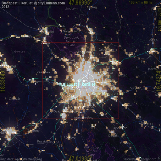
» Earth at Night: Flat Maps 2012, 2016