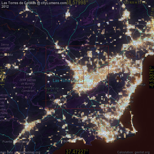
Las Torres de Cotillas night lights from space
Night Light of Las Torres de Cotillas (Murcia) from space (Spain) Src. Average luminocity for 10x10km area is 52.138% and for 50x50km: 22.5864%.
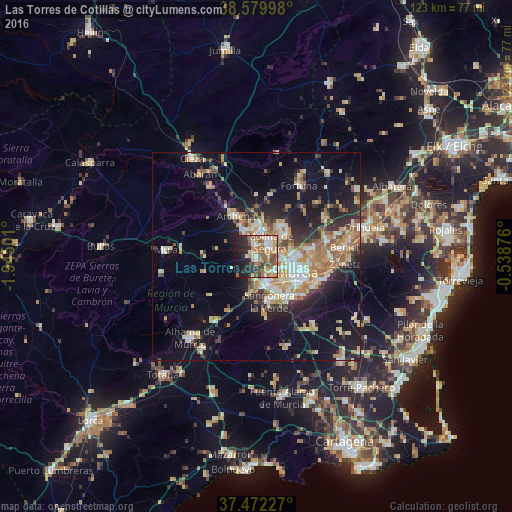
Analysis of Las Torres de Cotillas night lights 2016
Square area 10x10 km:
 7.31%
7.31%90-99
9.58%80-89
6.49%70-79
7.79%60-69
12.34%50-59
10.23%40-49
6.17%30-39
5.03%20-29
16.23%10-19
15.42%0-9
3.41%Square area 50x50 km:
2.63%90-99
3.83%80-89
2.89%70-79
3.77%60-69
4.23%50-59
2.6%40-49
2.21%30-39
2.77%20-29
6.03%10-19
13.31%0-9
55.74%Clear (daylight) street map image can be seen on geolist.org.
Map coordinates:
38° 34' 47.9" North, 1° 56' 42" West
38° 1' 41.6" North, 1° 14' 30.8" West
37° 28' 20.2" North, 0° 32' 19.5" West
Some cities around Las Torres de Cotillas sort by population:
• Murcia
10.8 km =6.7 mi,  115°
115°
• Molina de Segura
4.2 km =2.6 mi,  45°
45°
• Alcantarilla
6.9 km =4.3 mi,  161°
161°
• Archena
11.1 km =6.9 mi,  332°
332°
• Ceuti
6.3 km =3.9 mi, 332°
• Sangonera la Verde
11.5 km =7.1 mi, 164°
• Alguazas
2.9 km =1.8 mi,  344°
344°
• Lorquí
6.1 km =3.8 mi,  352°
352°
2515219 (p: 21,062)
Sources (retrieved 2019-11-25):
» Earth at Night: Flat Maps 2012, 2016