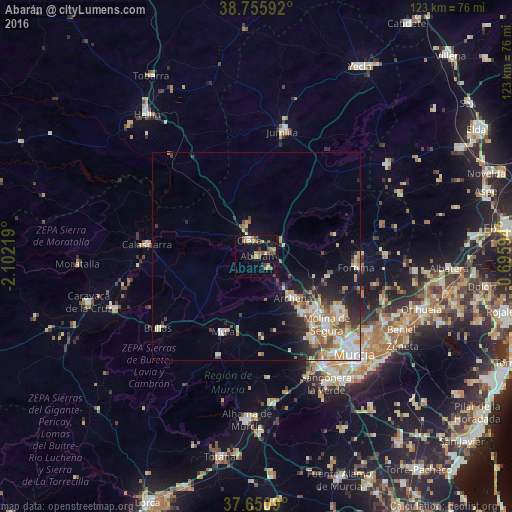
Abarán night lights from space
Night Light of Abarán (Murcia) from space (Spain) Src. Average luminocity for 10x10km area is 19.0663% and for 50x50km: 9.8825%.
Analysis of Abarán night lights 2016
Square area 10x10 km:
 1.02%
1.02%90-99
1.02%80-89
2.21%70-79
3.74%60-69
4.42%50-59
3.23%40-49
4.59%30-39
1.87%20-29
1.87%10-19
15.14%0-9
60.88%Square area 50x50 km:
1.44%90-99
1.77%80-89
1.14%70-79
1.5%60-69
1.65%50-59
1.21%40-49
1.35%30-39
1.1%20-29
2.29%10-19
4.58%0-9
81.97%Clear (daylight) street map image can be seen on geolist.org.
Map coordinates:
38° 45' 21.3" North, 2° 6' 7.9" West
38° 12' 19.8" North, 1° 23' 56.7" West
37° 39' 3.2" North, 0° 41' 45.4" West
Some cities around Abarán sort by population:
• Molina de Segura
23.7 km =14.7 mi,  135°
135°
• Cieza
4.2 km =2.6 mi,  334°
334°
• Archena
13.1 km =8.1 mi, 138°
• Mula
20 km =12.4 mi,  203°
203°
• Ceuti
17.8 km =11.1 mi, 142°
• Alguazas
21.3 km =13.2 mi, 142°
• Lorquí
18.8 km =11.7 mi, 136°
• Blanca
3.6 km =2.2 mi, 144°
2522499 (p: 12,991)
Sources (retrieved 2019-11-25):
» Earth at Night: Flat Maps 2012, 2016