Scheeßel night lights from space
Night Light of Scheeßel (Lower Saxony) from space (Germany) Src. Average luminocity for 10x10km area is 0.548% and for 50x50km: 0.4701%.
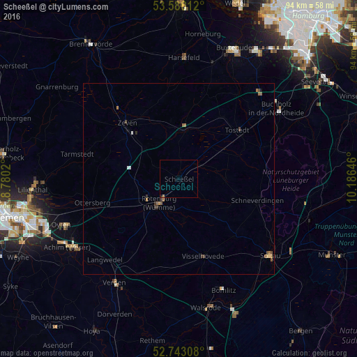
Analysis of Scheeßel night lights 2016
Square area 10x10 km:
 0%
0%90-99
0%80-89
0%70-79
0.51%60-69
0%50-59
0%40-49
0%30-39
0%20-29
0.13%10-19
0.38%0-9
98.99%Square area 50x50 km:
0.03%90-99
0.04%80-89
0.02%70-79
0.11%60-69
0.16%50-59
0.1%40-49
0.1%30-39
0.11%20-29
0.04%10-19
0.04%0-9
99.26%Clear (daylight) street map image can be seen on geolist.org.
Map coordinates:
53° 35' 10" North, 8° 46' 48.7" East
53° 10' 0" North, 9° 28' 60" East
52° 44' 35.1" North, 10° 11' 11.3" East
Some cities around Scheeßel sort by population:
• Rotenburg
7.8 km =4.8 mi,  218°
218°
• Schneverdingen
21.5 km =13.4 mi,  104°
104°
• Tostedt
20.2 km =12.6 mi,  50°
50°
• Zeven
19.9 km =12.4 mi,  316°
316°
• Visselhövede
21.2 km =13.2 mi,  161°
161°
• Sottrum
17.6 km =10.9 mi,  251°
251°
• Neuenkirchen
21.1 km =13.1 mi,  135°
135°
• Sittensen
12.3 km =7.6 mi,  6°
6°
2840070 (p: 12,907)
Sources (retrieved 2019-11-25):
» Earth at Night: Flat Maps 2012, 2016