Katlenburg-Lindau night lights from space
Night Light of Katlenburg-Lindau (Lower Saxony) from space (Germany) Src. Average luminocity for 10x10km area is 0.0196% and for 50x50km: 2.444%.
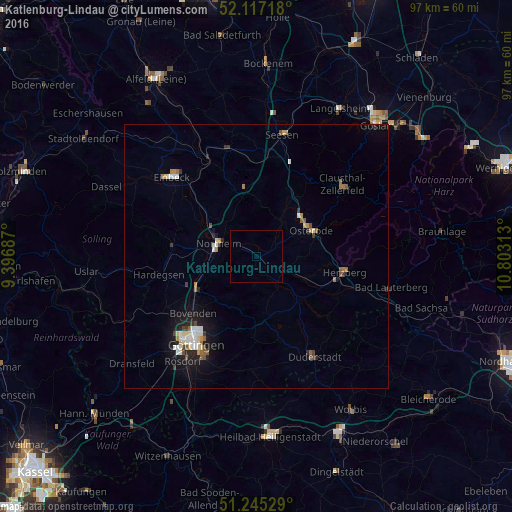
Analysis of Katlenburg-Lindau night lights 2016
Square area 10x10 km:
 0%
0%90-99
0%80-89
0%70-79
0%60-69
0%50-59
0%40-49
0%30-39
0%20-29
0%10-19
0%0-9
100%Square area 50x50 km:
0.31%90-99
0.49%80-89
0.24%70-79
0.19%60-69
0.33%50-59
0.36%40-49
0.24%30-39
0.26%20-29
0.41%10-19
1.79%0-9
95.38%Clear (daylight) street map image can be seen on geolist.org.
Map coordinates:
52° 7' 1.8" North, 9° 23' 48.7" East
51° 40' 60" North, 10° 6' 0" East
51° 14' 43" North, 10° 48' 11.3" East
Some cities around Katlenburg-Lindau sort by population:
• Göttingen
20.2 km =12.6 mi,  214°
214°
• Northeim
7.4 km =4.6 mi,  290°
290°
• Herzberg am Harz
16.8 km =10.4 mi,  100°
100°
• Bovenden
16.2 km =10.1 mi,  229°
229°
• Hardegsen
18.9 km =11.7 mi,  259°
259°
• Nörten-Hardenberg
12.8 km =8 mi,  241°
241°
• Moringen
15.9 km =9.9 mi,  276°
276°
• Kalefeld
13.8 km =8.6 mi,  340°
340°
3207077 (p: 7,581)
Sources (retrieved 2019-11-25):
» Earth at Night: Flat Maps 2012, 2016