Geisingen night lights from space
Night Light of Geisingen (Baden-Württemberg) from space (Germany) Src. Average luminocity for 10x10km area is 0.767% and for 50x50km: 5.8701%.
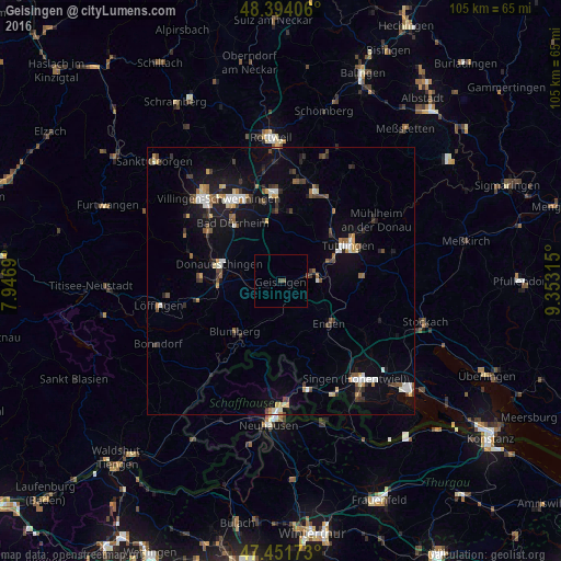
Analysis of Geisingen night lights 2016
Square area 10x10 km:
 0%
0%90-99
0%80-89
0%70-79
0%60-69
0%50-59
0.57%40-49
0.85%30-39
0%20-29
0%10-19
0%0-9
98.58%Square area 50x50 km:
0.61%90-99
0.91%80-89
0.43%70-79
0.59%60-69
0.62%50-59
0.8%40-49
0.85%30-39
0.97%20-29
1.06%10-19
4.17%0-9
88.99%Clear (daylight) street map image can be seen on geolist.org.
Map coordinates:
48° 23' 38.6" North, 7° 56' 48.8" East
47° 55' 30.1" North, 8° 39' 0.1" East
47° 27' 6.2" North, 9° 21' 11.3" East
Some cities around Geisingen sort by population:
• Tuttlingen
14.1 km =8.8 mi,  62°
62°
• Donaueschingen
11.9 km =7.4 mi,  286°
286°
• Bad Dürrheim
13.9 km =8.6 mi,  320°
320°
• Blumberg
12.8 km =8 mi,  222°
222°
• Engen
12 km =7.5 mi,  130°
130°
• Hüfingen
12 km =7.5 mi,  270°
270°
• Bräunlingen
15.1 km =9.4 mi, 271°
• Immendingen
6.3 km =3.9 mi,  81°
81°
2921682 (p: 6,048)
Sources (retrieved 2019-11-25):
» Earth at Night: Flat Maps 2012, 2016