Driedorf night lights from space
Night Light of Driedorf (Hesse) from space (Germany) Src. Average luminocity for 10x10km area is 0% and for 50x50km: 2.2206%.
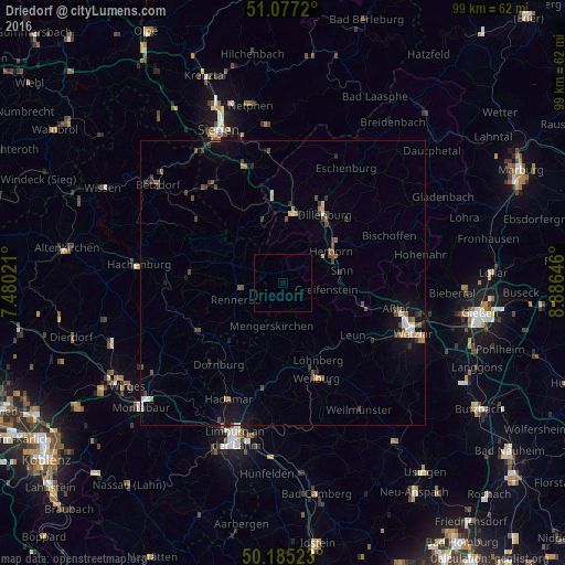
Analysis of Driedorf night lights 2016
Square area 10x10 km:
 0%
0%90-99
0%80-89
0%70-79
0%60-69
0%50-59
0%40-49
0%30-39
0%20-29
0%10-19
0%0-9
100%Square area 50x50 km:
0.2%90-99
0.22%80-89
0.12%70-79
0.22%60-69
0.29%50-59
0.37%40-49
0.56%30-39
0.58%20-29
0.28%10-19
1.42%0-9
95.75%Clear (daylight) street map image can be seen on geolist.org.
Map coordinates:
51° 4' 37.9" North, 7° 28' 48.8" East
50° 37' 60" North, 8° 10' 60" East
50° 11' 6.8" North, 8° 53' 11.3" East
Some cities around Driedorf sort by population:
• Dillenburg
14 km =8.7 mi,  31°
31°
• Herborn
10 km =6.2 mi,  57°
57°
• Haiger
12.2 km =7.6 mi,  8°
8°
• Ehringshausen
14.6 km =9.1 mi,  104°
104°
• Greifenstein
8.4 km =5.2 mi, 102°
• Sinn
10.7 km =6.6 mi,  80°
80°
• Waldbrunn
13.8 km =8.6 mi,  202°
202°
• Mengerskirchen
8 km =5 mi,  194°
194°
2934965 (p: 5,213)
Sources (retrieved 2019-11-25):
» Earth at Night: Flat Maps 2012, 2016