Bedburg night lights from space
Night Light of Bedburg (North Rhine-Westphalia) from space (Germany) Src. Average luminocity for 10x10km area is 17.9933% and for 50x50km: 27.2812%.
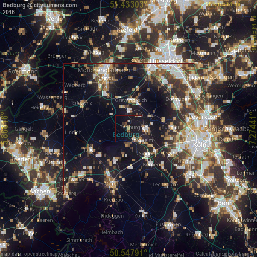
Analysis of Bedburg night lights 2016
Square area 10x10 km:
 2.14%
2.14%90-99
1.34%80-89
1.6%70-79
2.14%60-69
1.34%50-59
2.27%40-49
3.61%30-39
1.6%20-29
2.67%10-19
39.04%0-9
42.25%Square area 50x50 km:
4.16%90-99
5.07%80-89
2.35%70-79
2.91%60-69
3.56%50-59
3.76%40-49
4.58%30-39
4.73%20-29
6.22%10-19
22.43%0-9
40.23%Clear (daylight) street map image can be seen on geolist.org.
Map coordinates:
51° 25' 58.9" North, 5° 52' 5.4" East
50° 59' 33.3" North, 6° 34' 16.6" East
50° 32' 52.5" North, 7° 16' 27.9" East
Some cities around Bedburg sort by population:
• Grevenbroich
11 km =6.8 mi,  4°
4°
• Kerpen
16.2 km =10.1 mi,  147°
147°
• Bergheim
6.3 km =3.9 mi,  130°
130°
• Jüchen
12.9 km =8 mi,  337°
337°
• Elsdorf
6.1 km =3.8 mi,  181°
181°
• Niederzier
14.2 km =8.8 mi,  211°
211°
• Rommerskirchen
9.1 km =5.7 mi,  59°
59°
• Titz
10.4 km =6.5 mi,  278°
278°
2951648 (p: 24,937)
Sources (retrieved 2019-11-25):
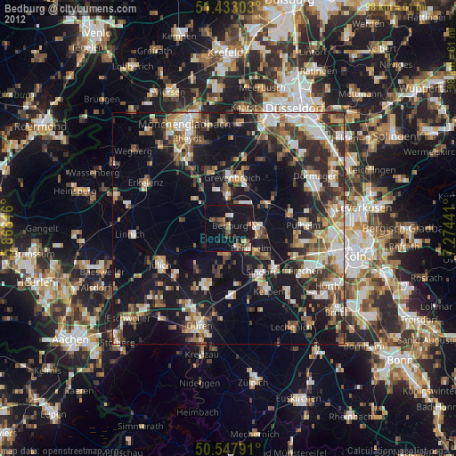
» Earth at Night: Flat Maps 2012, 2016