Holguín night lights from space
Night Light of Holguín from space (Cuba) Src. Average luminocity for 10x10km area is 63.0258% and for 50x50km: 6.3273%.
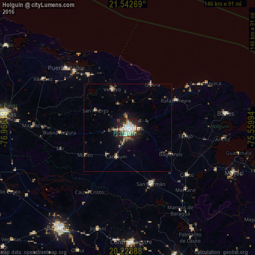
Analysis of Holguín night lights 2016
Square area 10x10 km:
 12.3%
12.3%90-99
23.61%80-89
7.94%70-79
5.16%60-69
4.96%50-59
5.56%40-49
7.74%30-39
6.94%20-29
20.44%10-19
5.36%0-9
0%Square area 50x50 km:
0.59%90-99
1.28%80-89
0.74%70-79
0.63%60-69
0.48%50-59
0.69%40-49
1.19%30-39
1.37%20-29
2.37%10-19
3.68%0-9
86.97%Clear (daylight) street map image can be seen on geolist.org.
Map coordinates:
21° 32' 33.7" North, 76° 57' 58.3" West
20° 53' 14" North, 76° 15' 47" West
20° 13' 44" North, 75° 33' 35.8" West
Some cities around Holguín sort by population:
• Puerto Padre
49.2 km =30.6 mi,  314°
314°
• Jesús Menéndez
37.8 km =23.5 mi,  323°
323°
• San Germán
34.6 km =21.5 mi,  157°
157°
• Cacocum
17.9 km =11.1 mi,  201°
201°
• Gibara
28.3 km =17.6 mi,  28°
28°
• Cueto
43.7 km =27.2 mi,  127°
127°
• Cauto Cristo
42.7 km =26.5 mi,  210°
210°
• Jobabo
9.9 km =6.2 mi,  337°
337°
3556969 (p: 319,102)
Sources (retrieved 2019-11-25):
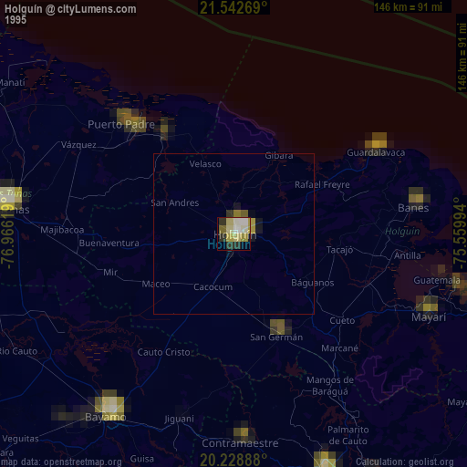
» NASA, Earths city lights 1995
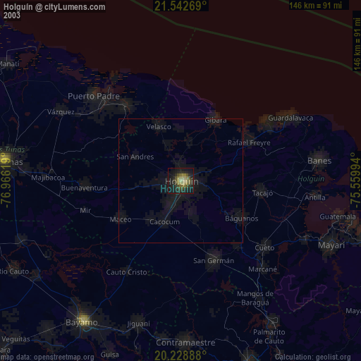
» NASA city lights 2003
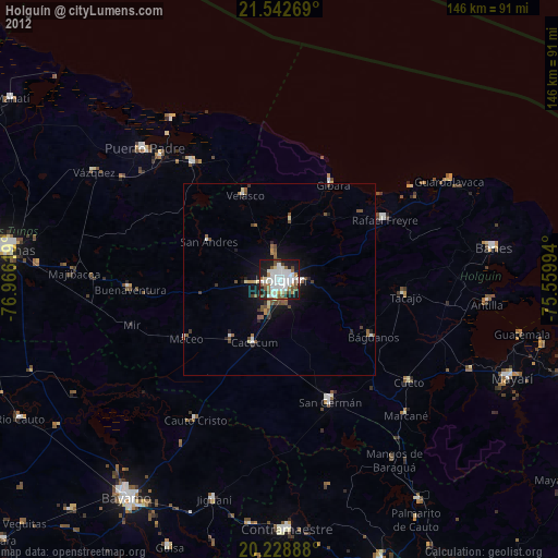
» Earth at Night: Flat Maps 2012, 2016