Nanding night lights from space
Night Light of Nanding (Shandong) from space (China) Src. Average luminocity for 10x10km area is 65.0787% and for 50x50km: 32.6852%.
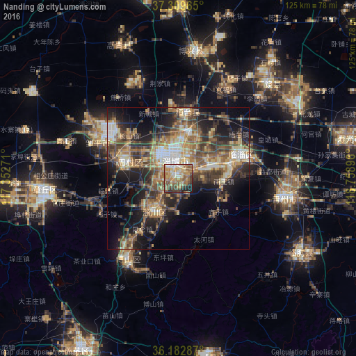
Analysis of Nanding night lights 2016
Square area 10x10 km:
 7.52%
7.52%90-99
8.04%80-89
13.29%70-79
15.38%60-69
16.61%50-59
15.03%40-49
9.27%30-39
6.47%20-29
6.12%10-19
2.27%0-9
0%Square area 50x50 km:
2.82%90-99
3.83%80-89
5.42%70-79
5.15%60-69
6.07%50-59
6.69%40-49
6.26%30-39
7.37%20-29
8.9%10-19
13.05%0-9
34.44%Clear (daylight) street map image can be seen on geolist.org.
Map coordinates:
37° 18' 34.7" North, 117° 21' 9.8" East
36° 44' 54" North, 118° 3' 21" East
36° 10' 58.3" North, 118° 45' 32.3" East
Some cities around Nanding sort by population:
• Zibo
4.7 km =2.9 mi,  8°
8°
• Boshan
35.5 km =22.1 mi,  213°
213°
• Zhoucun
22.6 km =14 mi,  289°
289°
• Qingzhou
38.2 km =23.7 mi,  98°
98°
• Mingshui
49.7 km =30.9 mi,  265°
265°
• Xindian
21.9 km =13.6 mi,  75°
75°
• Linqu
50.3 km =31.3 mi,  120°
120°
• Suozhen
23.3 km =14.5 mi, 10°
1800107 (p: 85,495)
Sources (retrieved 2019-11-25):
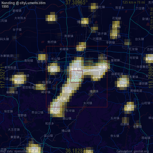
» NASA, Earths city lights 1995
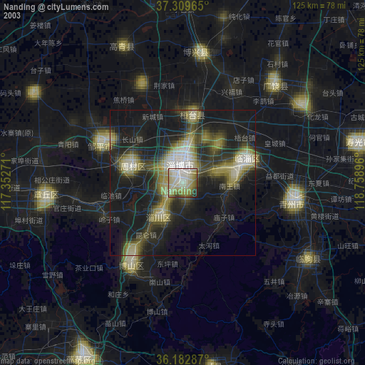
» NASA city lights 2003
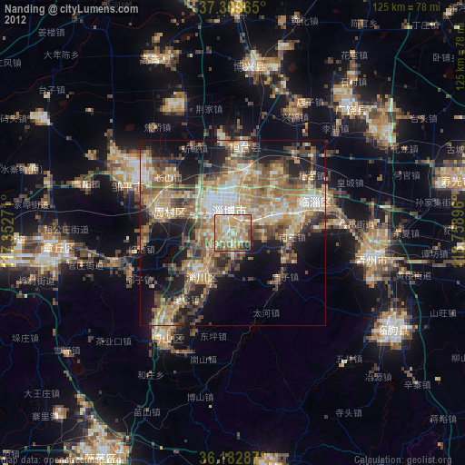
» Earth at Night: Flat Maps 2012, 2016