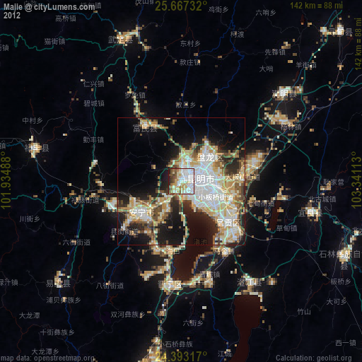
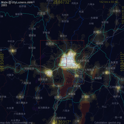
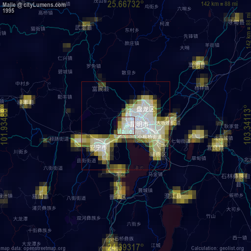
Majie night lights from space
Night Light of Majie (Yunnan) from space (China) Src. Average luminocity for 10x10km area is 76.1439% and for 50x50km: 37.301%.

Analysis of Majie night lights 2016
Square area 10x10 km:
 29.55%
90-99
19.51%80-89
6.06%70-79
7.77%60-69
10.42%50-59
5.49%40-49
8.14%30-39
2.84%20-29
9.09%10-19
1.14%0-9
0%Square area 50x50 km:
8.42%90-99
6.74%80-89
6.02%70-79
6.5%60-69
4.88%50-59
2.96%40-49
5.25%30-39
3.84%20-29
7.31%10-19
10.73%0-9
37.36%Clear (daylight) street map image can be seen on geolist.org.
Map coordinates:
25° 40' 2.4" North, 101° 56' 5.6" East
25° 1' 54.8" North, 102° 38' 16.8" East
24° 23' 35.4" North, 103° 20' 28.1" East
Some cities around Majie sort by population:
• Kunming
8.1 km =5 mi,  84°
84°
• Qujing
125.6 km =78 mi,  66°
66°
• Haikou
28.7 km =17.8 mi,  192°
192°
• Lianran
19.6 km =12.2 mi,  231°
231°
• Yuxi
75.9 km =47.2 mi, 187°
• Longquan
62.6 km =38.9 mi, 230°
• Miyang
107.1 km =66.5 mi,  130°
130°
• Shilin
73.9 km =45.9 mi,  108°
108°
1801401 (p: 131,696)
Sources (retrieved 2019-11-25):
» NASA, Earths city lights 1995
» NASA city lights 2003
» Earth at Night: Flat Maps 2012, 2016