Salvador night lights from space
Night Light of Salvador (Bahia) from space (Brazil) Src. Average luminocity for 10x10km area is 75.9481% and for 50x50km: 28.5328%.
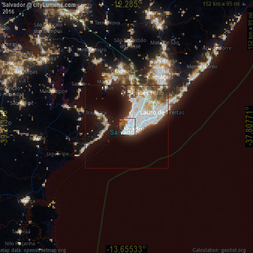
Analysis of Salvador night lights 2016
Square area 10x10 km:
 48.48%
90-99
13.42%80-89
0.87%70-79
0%60-69
1.95%50-59
7.58%40-49
7.14%30-39
4.55%20-29
9.74%10-19
6.28%0-9
0%Square area 50x50 km:
8.62%90-99
8.86%80-89
1.5%70-79
1.68%60-69
1.98%50-59
3.02%40-49
2.85%30-39
3.15%20-29
4.53%10-19
11.65%0-9
52.15%Clear (daylight) street map image can be seen on geolist.org.
Map coordinates:
12° 17' 6" South, 39° 12' 50.3" West
12° 58' 16" South, 38° 30' 39" West
13° 39' 19.2" South, 37° 48' 27.8" West
Some cities around Salvador sort by population:
• Camaçari
36.5 km =22.7 mi,  33°
33°
• Lauro de Freitas
21.6 km =13.4 mi,  66°
66°
• Simões Filho
23.8 km =14.8 mi, 29°
• São Francisco do Conde
42.4 km =26.3 mi,  334°
334°
• Maragogipe
49.2 km =30.6 mi,  295°
295°
• Itaparica
20.4 km =12.7 mi, 296°
• Saubara
38.2 km =23.7 mi,  312°
312°
• Madre de Deus
28.2 km =17.5 mi,  335°
335°
3450554 (p: 2,711,840)
Sources (retrieved 2019-11-25):
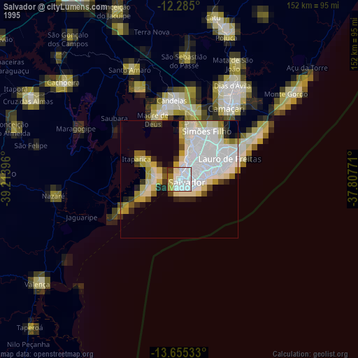
» NASA, Earths city lights 1995
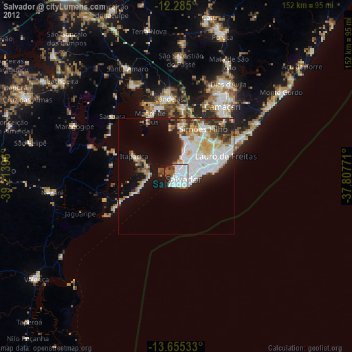
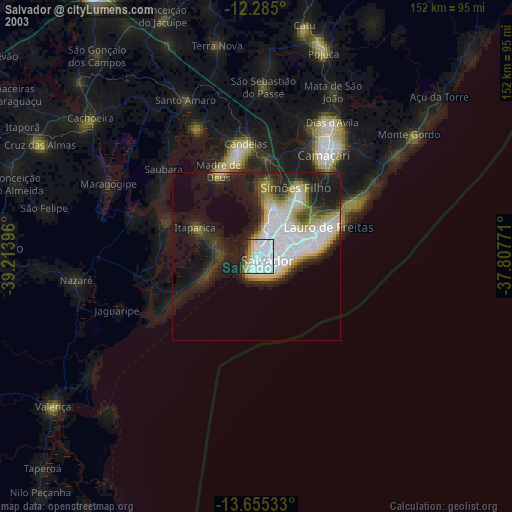
» NASA city lights 2003
» Earth at Night: Flat Maps 2012, 2016