Goianinha night lights from space
Night Light of Goianinha (Rio Grande do Norte) from space (Brazil) Src. Average luminocity for 10x10km area is 19.4784% and for 50x50km: 7.5071%.
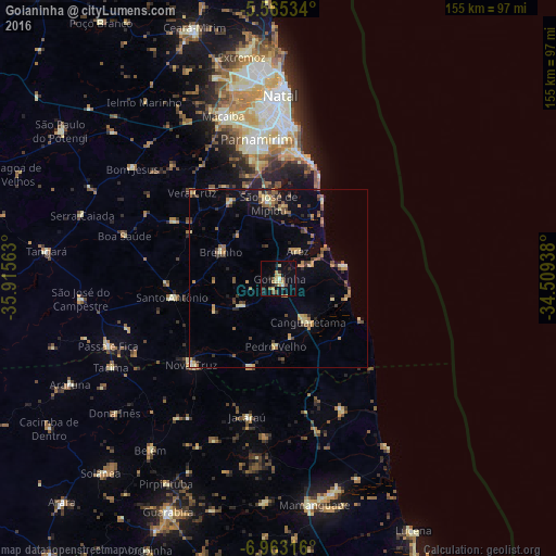
Analysis of Goianinha night lights 2016
Square area 10x10 km:
 0.43%
0.43%90-99
1.73%80-89
3.25%70-79
5.41%60-69
0.87%50-59
3.68%40-49
2.81%30-39
2.16%20-29
4.55%10-19
7.36%0-9
67.75%Square area 50x50 km:
0.03%90-99
0.4%80-89
1.44%70-79
1.18%60-69
1.1%50-59
1.71%40-49
1.09%30-39
1.26%20-29
1.26%10-19
2.58%0-9
87.95%Clear (daylight) street map image can be seen on geolist.org.
Map coordinates:
5° 33' 55.2" South, 35° 54' 56.3" West
6° 15' 53" South, 35° 12' 45" West
6° 57' 47.4" South, 34° 30' 33.8" West
Some cities around Goianinha sort by population:
• Canguaretama
15.8 km =9.8 mi,  144°
144°
• São José de Mipibu
21.3 km =13.2 mi,  352°
352°
• Santo Antônio
29.9 km =18.6 mi,  260°
260°
• Nísia Floresta
19.3 km =12 mi,  1°
1°
• Montanhas
25.9 km =16.1 mi,  198°
198°
• Brejinho
17.9 km =11.1 mi,  297°
297°
• Arês
9.7 km =6 mi,  36°
36°
• Pedro Velho
19.4 km =12.1 mi,  182°
182°
3398902 (p: 13,433)
Sources (retrieved 2019-11-25):
» Earth at Night: Flat Maps 2012, 2016