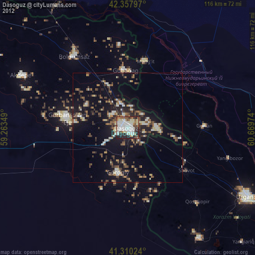
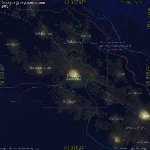
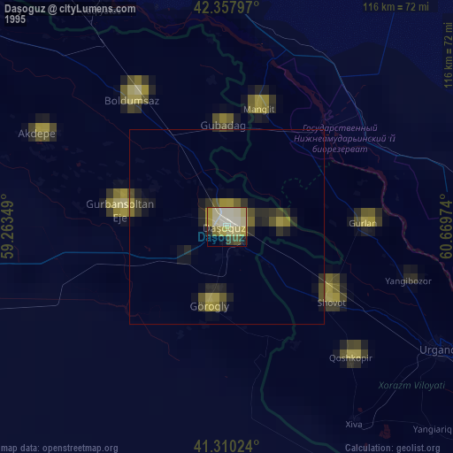
Daşoguz night lights from space
Night Light of Daşoguz from space (Turkmenistan) Src. Average luminocity for 10x10km area is 76.8206% and for 50x50km: 13.085%.

Analysis of Daşoguz night lights 2016
Square area 10x10 km:
 23.65%
90-99
24.29%80-89
4.44%70-79
14.6%60-69
3.02%50-59
8.57%40-49
11.59%30-39
7.46%20-29
2.38%10-19
0%0-9
0%Square area 50x50 km:
1.22%90-99
1.56%80-89
1.06%70-79
1.73%60-69
1.52%50-59
1.77%40-49
2.82%30-39
3.65%20-29
3.99%10-19
9.13%0-9
71.55%Clear (daylight) street map image can be seen on geolist.org.
Map coordinates:
42° 21' 28.7" North, 59° 15' 48.6" East
41° 50' 10.5" North, 59° 57' 59.8" East
41° 18' 36.9" North, 60° 40' 11.1" East
Some cities around Daşoguz sort by population:
• Manghit, UZ
32 km =19.9 mi,  13°
13°
• Gurlan, UZ
35.2 km =21.9 mi,  88°
88°
• Showot, UZ
34.3 km =21.3 mi,  125°
125°
• Yylanly
26.2 km =16.3 mi,  269°
269°
• Boldumsaz
40.6 km =25.2 mi,  323°
323°
• Qŭshkŭpir, UZ
46 km =28.6 mi,  136°
136°
• Tagta
21.1 km =13.1 mi,  191°
191°
• Akdepe
54.4 km =33.8 mi,  296°
296°
601734 (p: 166,500)
Sources (retrieved 2019-11-25):
» NASA, Earths city lights 1995
» NASA city lights 2003
» Earth at Night: Flat Maps 2012, 2016