Puerto Pilón night lights from space
Night Light of Puerto Pilón (Colón) from space (Panama) Src. Average luminocity for 10x10km area is 33.5952% and for 50x50km: 7.9859%.
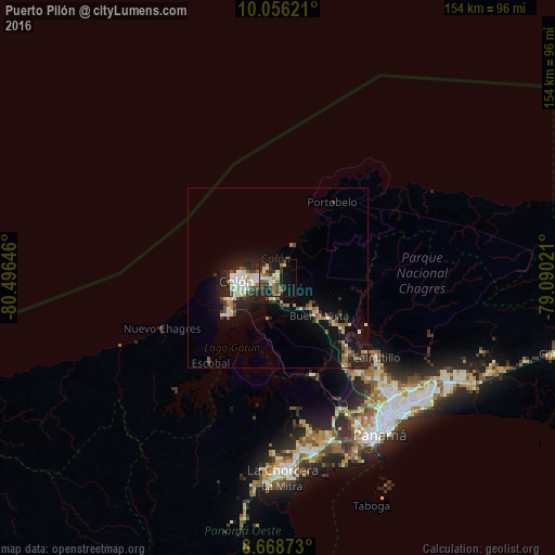
Analysis of Puerto Pilón night lights 2016
Square area 10x10 km:
 2.6%
2.6%90-99
7.58%80-89
3.25%70-79
1.95%60-69
7.36%50-59
4.11%40-49
3.68%30-39
9.09%20-29
12.99%10-19
26.41%0-9
21%Square area 50x50 km:
0.77%90-99
1.56%80-89
0.82%70-79
0.65%60-69
0.93%50-59
1.07%40-49
1.13%30-39
1.41%20-29
2.66%10-19
6.89%0-9
82.11%Clear (daylight) street map image can be seen on geolist.org.
Map coordinates:
10° 3' 22.4" North, 80° 29' 47.3" West
9° 21' 47.4" North, 79° 47' 36" West
8° 40' 7.4" North, 79° 5' 24.8" West
Some cities around Puerto Pilón sort by population:
• Colón
11.8 km =7.3 mi,  265°
265°
• Chilibre
30.2 km =18.8 mi,  141°
141°
• Cativá
4.3 km =2.7 mi, 268°
• Alcalde Díaz
37.5 km =23.3 mi, 136°
• La Cabima
39.2 km =24.4 mi,  133°
133°
• Sabanitas
2.9 km =1.8 mi,  218°
218°
• Villa Unida
26.8 km =16.7 mi, 136°
• San Vicente
35 km =21.7 mi, 142°
3702384 (p: 8,754)
Sources (retrieved 2019-11-25):
» Earth at Night: Flat Maps 2012, 2016