Puerto Escondido night lights from space
Night Light of Puerto Escondido (Colón) from space (Panama) Src. Average luminocity for 10x10km area is 0.8095% and for 50x50km: 3.144%.
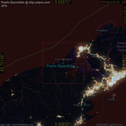
Analysis of Puerto Escondido night lights 2016
Square area 10x10 km:
 0%
0%90-99
0%80-89
0%70-79
0%60-69
0%50-59
0%40-49
0.87%30-39
0%20-29
1.73%10-19
0%0-9
97.4%Square area 50x50 km:
0.59%90-99
0.82%80-89
0.29%70-79
0.09%60-69
0.18%50-59
0.34%40-49
0.42%30-39
0.55%20-29
1.05%10-19
2.34%0-9
93.32%Clear (daylight) street map image can be seen on geolist.org.
Map coordinates:
9° 53' 12.2" North, 80° 47' 29.3" West
9° 11' 36" North, 80° 5' 18" West
8° 29' 54.9" North, 79° 23' 6.8" West
Some cities around Puerto Escondido sort by population:
• Colón
27.3 km =17 mi,  49°
49°
• La Chorrera
48.3 km =30 mi,  136°
136°
• Cativá
33.8 km =21 mi,  56°
56°
• Sabanitas
34.8 km =21.6 mi, 61°
• El Coco
47.6 km =29.6 mi, 139°
• Altos de San Francisco
49.3 km =30.6 mi, 138°
• La Pesa
47.9 km =29.8 mi, 142°
• Guadalupe
48.2 km =30 mi, 141°
3702412 (p: 12,371)
Sources (retrieved 2019-11-25):
» Earth at Night: Flat Maps 2012, 2016