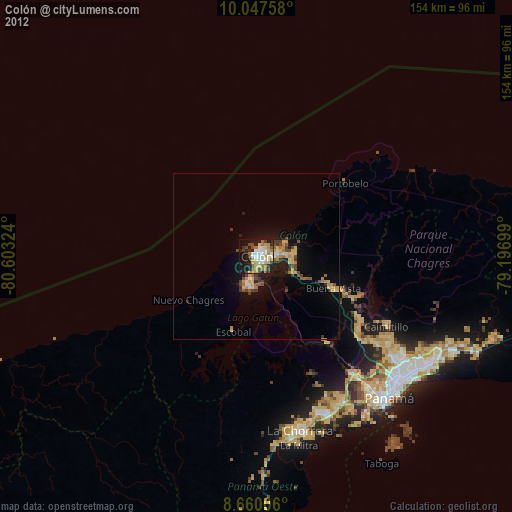
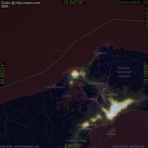
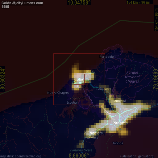
Colón night lights from space
Night Light of Colón from space (Panama) Src. Average luminocity for 10x10km area is 52.4913% and for 50x50km: 6.2862%.
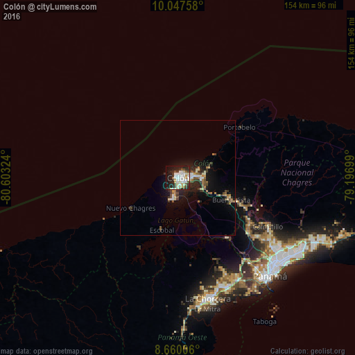
Analysis of Colón night lights 2016
Square area 10x10 km:
 13.64%
90-99
17.53%80-89
6.06%70-79
1.73%60-69
1.73%50-59
3.68%40-49
5.19%30-39
6.49%20-29
17.75%10-19
22.08%0-9
4.11%Square area 50x50 km:
0.77%90-99
1.37%80-89
0.59%70-79
0.36%60-69
0.72%50-59
0.69%40-49
1%30-39
1.03%20-29
2.12%10-19
4.81%0-9
86.54%Clear (daylight) street map image can be seen on geolist.org.
Map coordinates:
10° 2' 51.3" North, 80° 36' 11.7" West
9° 21' 16.2" North, 79° 54' 0.4" West
8° 39' 36.2" North, 79° 11' 49.2" West
Some cities around Colón sort by population:
• Chilibre
38.1 km =23.7 mi,  126°
126°
• Cativá
7.5 km =4.7 mi,  83°
83°
• Alcalde Díaz
45.8 km =28.5 mi,  124°
124°
• Sabanitas
10 km =6.2 mi,  97°
97°
• Villa Unida
35.4 km =22 mi, 121°
• San Vicente
42.6 km =26.5 mi, 128°
• Puerto Escondido
27.3 km =17 mi,  229°
229°
• Puerto Pilón
11.8 km =7.3 mi,  85°
85°
3712076 (p: 76,643)
Sources (retrieved 2019-11-25):
» NASA, Earths city lights 1995
» NASA city lights 2003
» Earth at Night: Flat Maps 2012, 2016