Weligama night lights from space
Night Light of Weligama (Southern) from space (Sri Lanka) Src. Average luminocity for 10x10km area is 6.7955% and for 50x50km: 2.9398%.
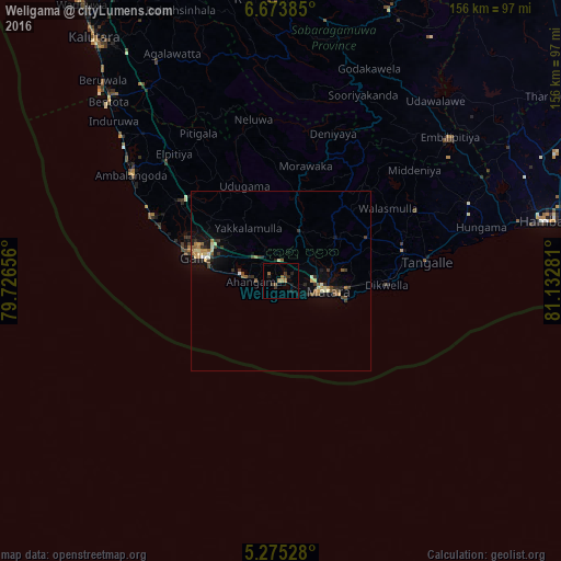
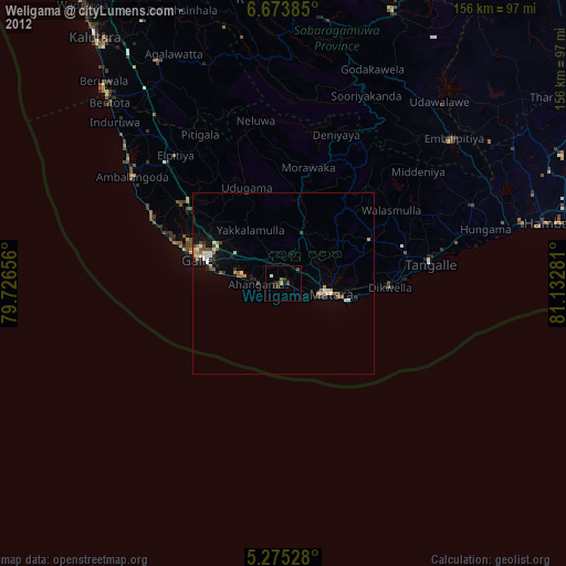
Analysis of Weligama night lights 2016
Square area 10x10 km:
 0%
0%90-99
0%80-89
0%70-79
0%60-69
3.93%50-59
0.83%40-49
0.41%30-39
2.69%20-29
2.89%10-19
3.31%0-9
85.95%Square area 50x50 km:
0.06%90-99
0.37%80-89
0.43%70-79
0.31%60-69
0.45%50-59
0.54%40-49
0.47%30-39
0.64%20-29
0.53%10-19
1.76%0-9
94.44%Clear (daylight) street map image can be seen on geolist.org.
Map coordinates:
6° 40' 25.9" North, 79° 43' 35.6" East
5° 58' 30" North, 80° 25' 46.8" East
5° 16' 31" North, 81° 7' 58.1" East
Some cities around Weligama sort by population:
• Galle
25.5 km =15.8 mi,  288°
288°
• Matara
12 km =7.5 mi,  104°
104°
• Devinuwara
18.3 km =11.4 mi,  106°
106°
• Bentota
69.4 km =43.1 mi,  316°
316°
• Beruwala
74.7 km =46.4 mi, 318°
• Ambalangoda
50.7 km =31.5 mi,  304°
304°
• Tangalle
41 km =25.5 mi,  82°
82°
• Horawala Junction
65.4 km =40.6 mi,  329°
329°
1223738 (p: 22,179)
Sources (retrieved 2019-11-25):
» Earth at Night: Flat Maps 2012, 2016