Matara night lights from space
Night Light of Matara (Southern) from space (Sri Lanka) Src. Average luminocity for 10x10km area is 19.2004% and for 50x50km: 1.7316%.
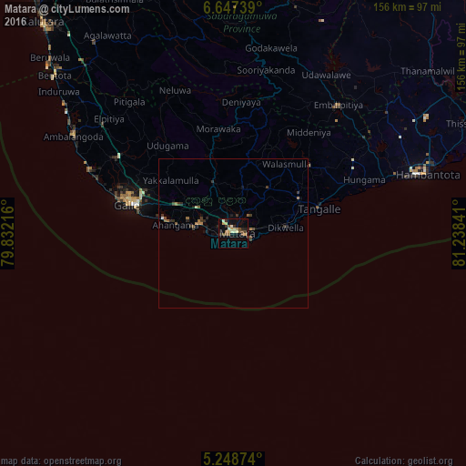
Analysis of Matara night lights 2016
Square area 10x10 km:
 0%
0%90-99
4.55%80-89
3.1%70-79
3.1%60-69
0.41%50-59
3.93%40-49
3.93%30-39
1.86%20-29
3.31%10-19
6.82%0-9
69.01%Square area 50x50 km:
0.03%90-99
0.2%80-89
0.16%70-79
0.15%60-69
0.27%50-59
0.37%40-49
0.37%30-39
0.5%20-29
0.38%10-19
0.64%0-9
96.95%Clear (daylight) street map image can be seen on geolist.org.
Map coordinates:
6° 38' 50.6" North, 79° 49' 55.8" East
5° 56' 54.6" North, 80° 32' 7" East
5° 14' 55.5" North, 81° 14' 18.3" East
Some cities around Matara sort by population:
• Galle
37.5 km =23.3 mi,  286°
286°
• Ratnapura
83.3 km =51.8 mi,  349°
349°
• Devinuwara
6.3 km =3.9 mi,  110°
110°
• Bentota
79.8 km =49.6 mi,  311°
311°
• Weligama
12 km =7.5 mi,  284°
284°
• Ambalangoda
62.1 km =38.6 mi,  300°
300°
• Tangalle
30.2 km =18.8 mi,  73°
73°
• Horawala Junction
74.4 km =46.2 mi,  322°
322°
1235846 (p: 76,254)
Sources (retrieved 2019-11-25):
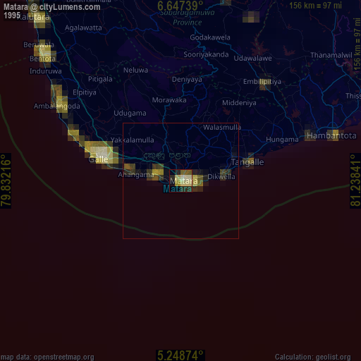
» NASA, Earths city lights 1995
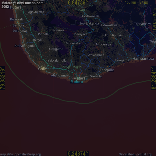
» NASA city lights 2003
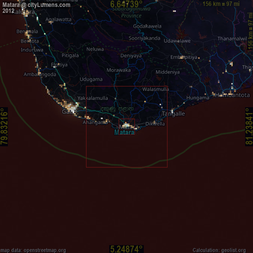
» Earth at Night: Flat Maps 2012, 2016