Sainte-Rose night lights from space
Night Light of Sainte-Rose (Guadeloupe) from space (Guadeloupe) Src. Average luminocity for 10x10km area is 17.5537% and for 50x50km: 11.3099%.
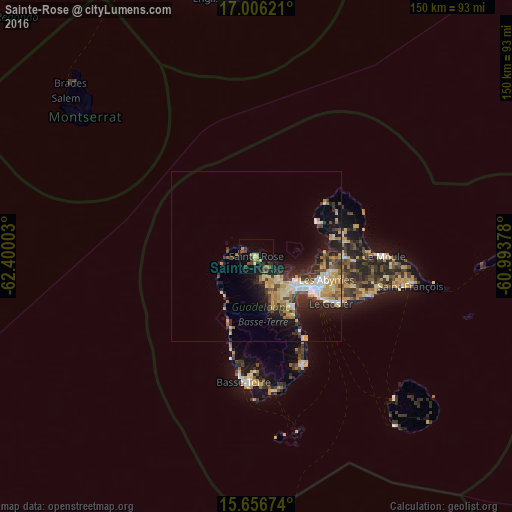
Analysis of Sainte-Rose night lights 2016
Square area 10x10 km:
 0.21%
0.21%90-99
0.62%80-89
2.27%70-79
3.72%60-69
3.31%50-59
2.48%40-49
2.07%30-39
5.58%20-29
3.72%10-19
16.53%0-9
59.5%Square area 50x50 km:
1.26%90-99
1.36%80-89
1.99%70-79
2.51%60-69
1.2%50-59
0.87%40-49
1.63%30-39
2.17%20-29
3.4%10-19
6.6%0-9
77.02%Clear (daylight) street map image can be seen on geolist.org.
Map coordinates:
17° 0' 22.4" North, 62° 24' 0.1" West
16° 19' 57.5" North, 61° 41' 48.8" West
15° 39' 24.3" North, 60° 59' 37.6" West
Some cities around Sainte-Rose sort by population:
• Les Abymes
21.5 km =13.4 mi,  107°
107°
• Baie-Mahault
13.9 km =8.6 mi,  121°
121°
• Petit-Bourg
19.3 km =12 mi,  144°
144°
• Pointe-à-Pitre
19.9 km =12.4 mi, 120°
• Lamentin
9.8 km =6.1 mi,  134°
134°
• Petit-Canal
23 km =14.3 mi,  76°
76°
• Pointe-Noire
14.9 km =9.3 mi,  221°
221°
• Port-Louis
20.1 km =12.5 mi,  62°
62°
3578447 (p: 20,192)
Sources (retrieved 2019-11-25):
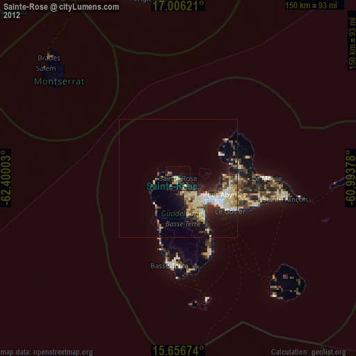
» Earth at Night: Flat Maps 2012, 2016