Grand-Bourg night lights from space
Night Light of Grand-Bourg (Guadeloupe) from space (Guadeloupe) Src. Average luminocity for 10x10km area is 5.658% and for 50x50km: 0.6166%.
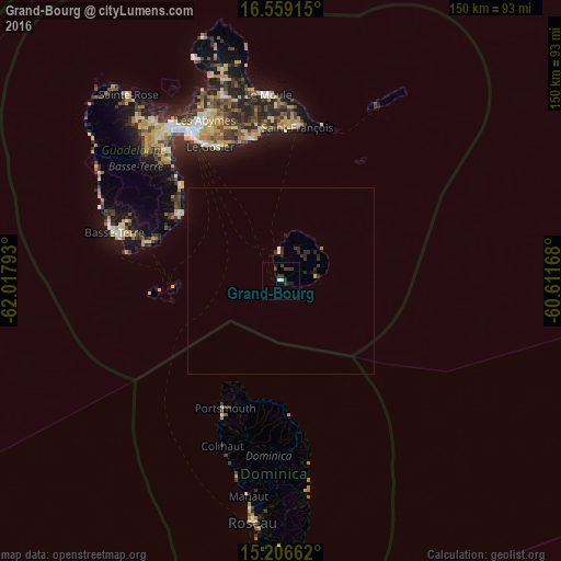
Analysis of Grand-Bourg night lights 2016
Square area 10x10 km:
 0.65%
0.65%90-99
0.22%80-89
0.87%70-79
0%60-69
0%50-59
0%40-49
1.08%30-39
5.84%20-29
1.52%10-19
1.95%0-9
87.88%Square area 50x50 km:
0.02%90-99
0.04%80-89
0.07%70-79
0.02%60-69
0.02%50-59
0.01%40-49
0.04%30-39
0.48%20-29
0.44%10-19
0.19%0-9
98.66%Clear (daylight) street map image can be seen on geolist.org.
Map coordinates:
16° 33' 32.9" North, 62° 1' 4.5" West
15° 53' 2.5" North, 61° 18' 53.3" West
15° 12' 23.8" North, 60° 36' 42" West
Some cities around Grand-Bourg sort by population:
• Le Gosier
40.6 km =25.2 mi,  331°
331°
• Sainte-Anne
38.6 km =24 mi,  349°
349°
• Capesterre-Belle-Eau
32.1 km =19.9 mi,  303°
303°
• Saint-François
41.2 km =25.6 mi,  6°
6°
• Trois-Rivières
36.7 km =22.8 mi,  286°
286°
• Gourbeyre
42.2 km =26.2 mi, 286°
• Portsmouth, DM
37.2 km =23.1 mi,  205°
205°
• Wesley, DM
35.3 km =21.9 mi,  180°
180°
3579250 (p: 5,867)
Sources (retrieved 2019-11-25):
» Earth at Night: Flat Maps 2012, 2016